We spent the night in a huge lorry park at the Turkish border with Iran after talking to the owners. When we arrived there must have been at least 200 lorries and we presumed that they would stay the night there and their drivers would eat in the large restaurant. We were astonished to see the restaurant close and then the lorries leave one after the other in a huge convoy for Iran. Alone in the huge park, we had a very pleasant night’s sleep.
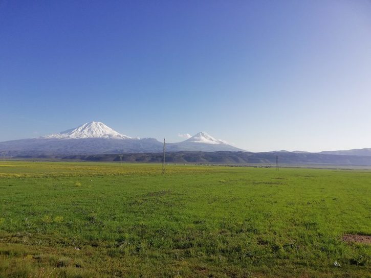
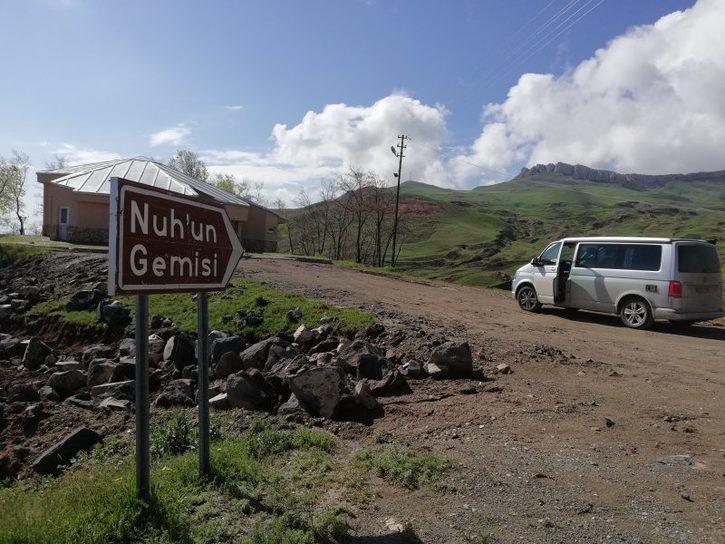
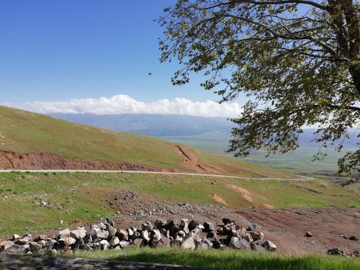
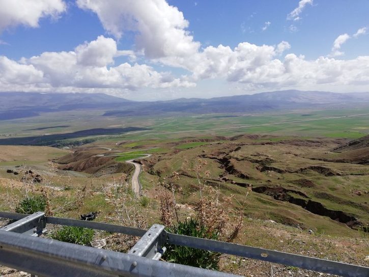
The vision of Mount Ararat in the morning was dramatic, like a huge white cone. Good job we got up early because it was soon covered in mist. We then drove back to Dogubayezit to see the alleged site of Nehun Gunizi (Noah’s Ark), which is located on th top of a mountain the opposite side of the valley from Mt Ararat. Jennifer wanted to get out to photo a huge flock of sheep and was immediately assailed by four huge Anatolian mastiffs with deafening barks. She stood petrified with her back to them and edged her way into the van. The shepherd smiled, presumably knowing that they wouldn’t attack her, but they chased the van for perhaps 500 metres.
The site of Noah’s Ark is somewhat disappointing, with a dilapidated museum and cafe which was closed. There is an outline of a boat in the hillside, where it ostensibly landed before its timbers rotted away, but you need a bit of imagination.
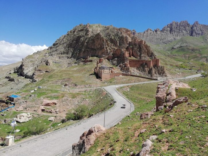
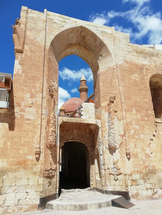
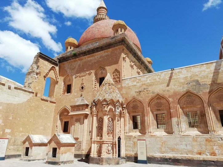
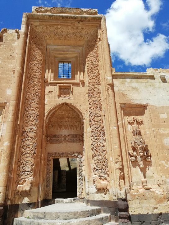
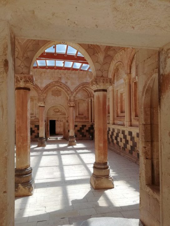
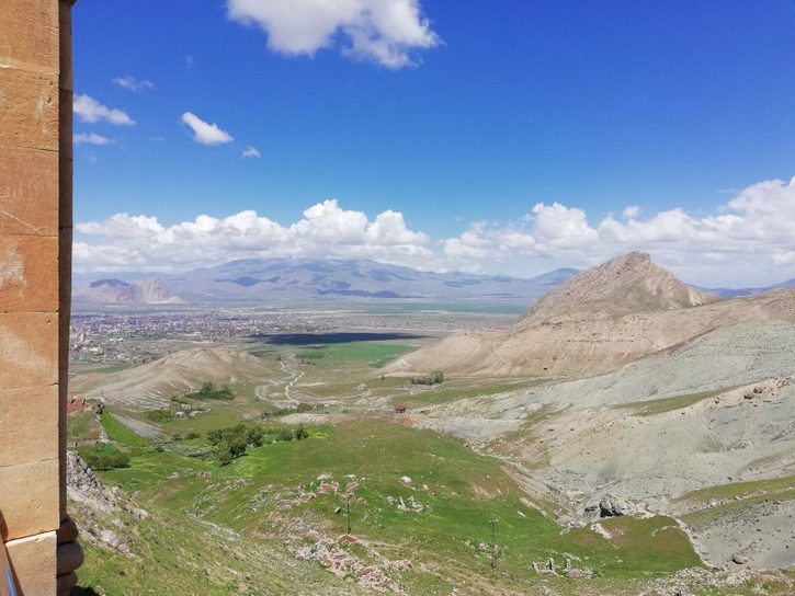
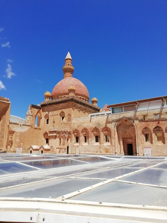
The real attraction in Dogubayezit is the Ishakpasha Saraya. Archaeological research conducted to the west of Doğubayazıt Fortress revealed some stone finds dating as far back as the Urartian era. Therefore, it is usually assumed that the earliest settlement in the area goes back to around 800 BC. Moreover, a well-fortified town existed there at least since the 4th century AD. In the middle of the 14th century, the region was controlled by the Jalairids. They were a Mongol dynasty that ruled over Iraq and western Persia after the breakup of the Mongol Khanate of Persia. Their domination was disrupted by Timur’s conquests and the revolts of the Kara Koyunlu Turkmen.
Doğubayazıt area became a part of the Ottoman Empire in 1514. Soon afterwards, the old Doğubayazıt Fortress was abandoned and its walls were partly demolished. Most probably, some of the materials were later used for the construction of Ishak Pasha Palace. At the head of Bayazit Sanjak stood an official with the title of mütesarrıf, appointed directly by the sultan. This position became hereditary within the Kurdish family dynasty of Çildıroğulları.
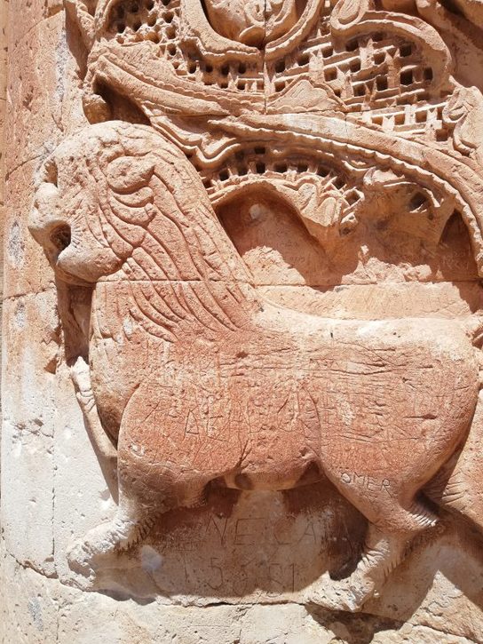
The building of the palace started around the year 1685, on the orders of Çolak Abdi Pasha. The palace was erected very slowly, and its construction was supervised by the generations of the Çildıroğulları. Another member of this family was İshak Pasha who held the position of a vizier in 1723, and the next year was appointed the governor of Tbilisi. His grandson Hasan became the governor of Çıldır in 1760-1761. Another İshak, also the governor of Çıldır, finished the long process of the palace construction. The date of the completion is given by the inscription located above the portal to the harem. It is the Islamic year 1199, corresponding to 1784-1785 CE. At the time of the construction of the palace, the town expanded in the plain below the palace hill.
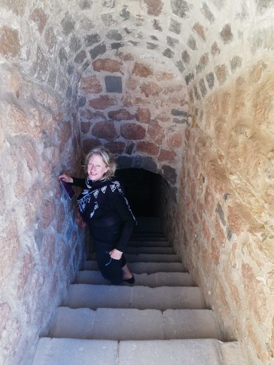
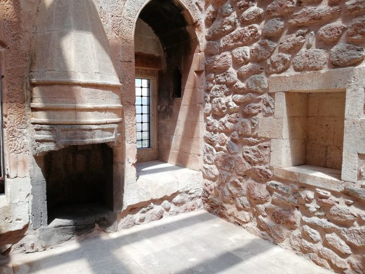
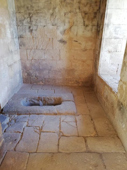
It is assumed that the last pasha of the Çildıroğulları dynasty, who inhabited the entire palace, was Mahmut. He is the only member of the family whose tomb is located in the burial chamber below the palace courtyard. The date of his death is illegible on the gravestone, but now it is known that he died in 1805. His successor, Behlül, moved his residence from the palace to the fortress. He resided there when the Russians arrived during the Russo-Ottoman War of 1828. The Russian occupation lasted just one year but much of the wooden structure of the palace was destroyed in that period. The harem doors, plated with gold, as well as documents from the library of the palace were plundered and taken to Russia. It is a great shame as these documents could provide precious information about the construction of the complex.
Moreover, an earthquake in 1840 caused severe damage both to the palace and the fortress. By 1860, some rooms had been restored, but the next Russo-Ottoman War erupted in 1877. The palace served as a military shelter, and it was damaged again. This time, the Russians occupied the region until the First World War when they used it as a military post. Further damage to the palace was made by gunfire, as the city was fought over because of its strategic position between Russian and Turkish troops.
In the early days of the Turkish Republic, the palace served as the administrative centre for Ağrı Province and the Bayazıt District. In 1926, the provincial administration moved to the city of Ağrı, and the administration for Bayazıt District relocated into the plain below. Then the palace was used as a cavalier military post, to 1937. Until the early 1930s, the palace was surrounded by the town now called Eski (Old) Bayazıt, originally an Armenian settlement. It was demolished by the Turkish army after a Kurdish uprising, also known as Ararat Rebellion, in 1930. In the following period, the palace was further damaged when stone blocks from its walls were removed as the construction material for nearby mansions.
We then drove to Kars, looking for the ancient abandoned city of Ani and, after a round-trip of 50 miles on the wrong road, finally reached the city walls and stayed there for the night. Turkish flags at half-mast for 57 Palestinians.